
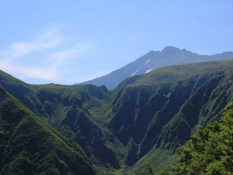
Naso Canyon lies north of Mt. Chōkai’s 6th Station, with a depth ranging 300–500 m and a width ranging 500–1000 m. Right below the observation point it is v-shaped, with a depth of 337 m.
The river flowing through the bottom of the canyon is Naso River. The river carved and deepened the canyon over an incredibly long period of time. It us unclear why this is the only place that was carved out.
Mt. Chōkai began to form around 600 thousand years ago. Since then, it has erupted a countless number of times. Naso Canyon cuts deep into the mountain, allowing us to observe upon its walls layer upon layer of volcanic rock from different eruptions.
The lower part of the canyon is made up of volcanic rock from 400–450 thousand years ago, which is relatively old for Mt. Chōkai. The upper part of the canyon is made up of volcanic rock from about 100 thousand years ago.


