 Yurihonjō Area
Yurihonjō Area All
Geological Sites
Natural Sites
Cultural Sites
Viewpoints
Facilities

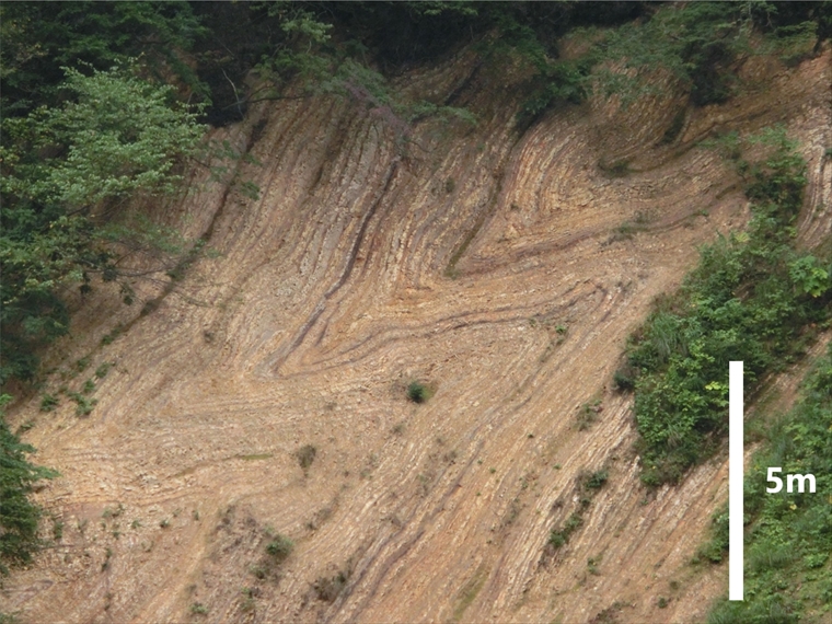
- Large Fold Outcrop, Miyazawa Forest Road
- Three million years ago, tectonic plate movement began pushing on the Japanese archipelago from the ...
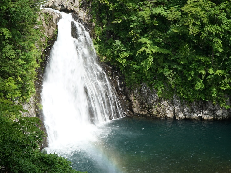
- Hottai Waterfall and Potholes
- In an eruption of Mt. Chokai about 100 thousand years ago, a large amount of lava flowed out, creati...
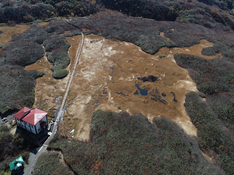
- Ryūgahara Wetland
- Located at the Yashima-guchi Trailhead of Mt. Chokai at an elevation of 1,170 m, Ryūgahara Wetland i...

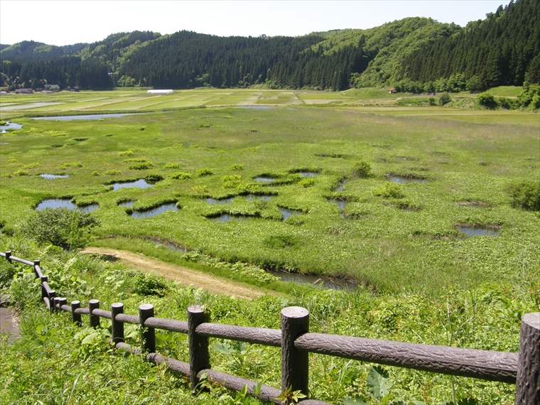
- Katakinuma Wetland
- Located at a low elevation of about 30 m, this wetland is thought to be the remains of the flow of t...
- Kuwanokidai Wetland
- This wetland is located at an elevation of 690 m, created by the debris avalanche of Mt. Chokai long...

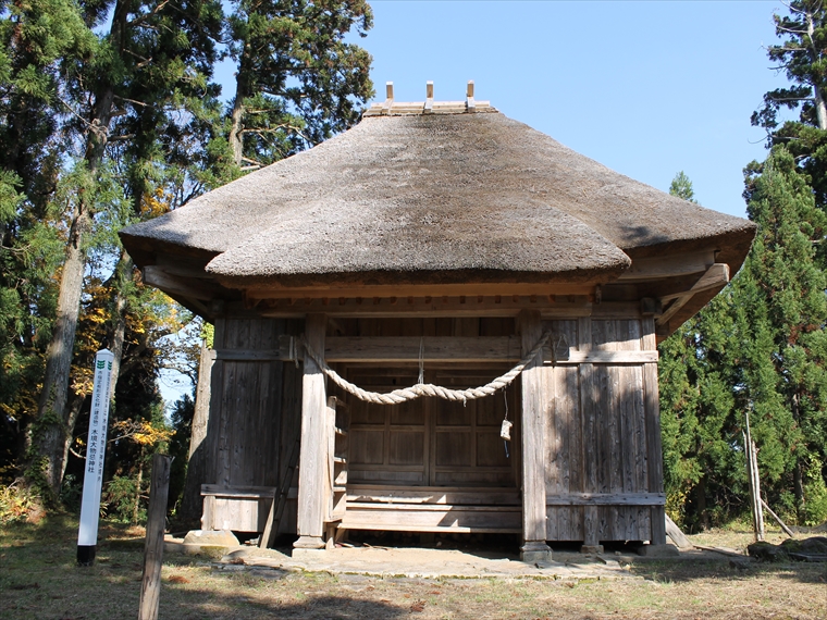
- Moriko Ōmonoimi Shrine
- This shrine has a sacred atmosphere and is surrounded by Japanese cedar trees (Cryptomeria japonica)...
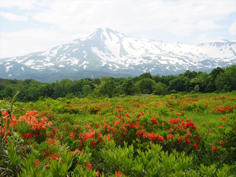
- Yurihara Plateau
- Over a long period of time, a large portion of land that accumulated from a debris avalanche on Mt. ...
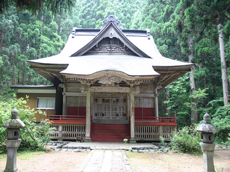
- Kizakai Ōmonoimi Shrine
- Kizakai Ōmonoimi Shrine was once a hub for practitioners of the ascetic religion Shugendō in the Yas...

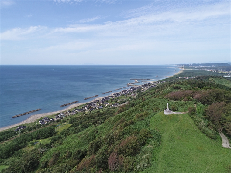
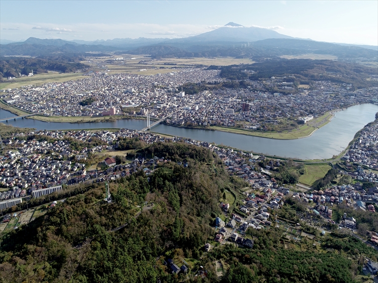
- Hamadate Park
- From this view point, you can see the land created by the sector collapse of Mt. Chokai. This castle...

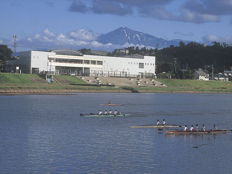
- Yurihonjō City Boat Plaza Aquapal
- This unique facility is made up of a sports zone, a museum, and a cultural activities zone. The spor...
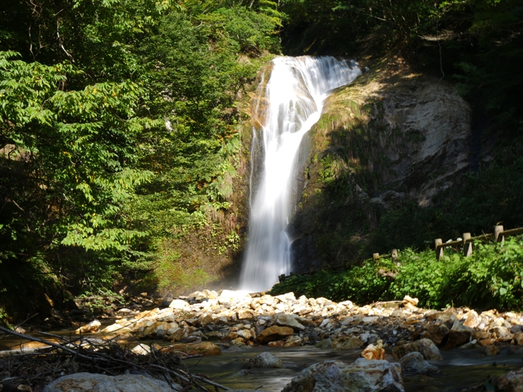
- Kameda Fudō Waterfall
- Located around 150 m above sea level, Kameda Fudō Waterfall stands about 25 m tall and 10 m wide. It...
- Akata-ōtaki Waterfall
- This 23-meter-tall waterfall has an interesting shape, causing its flow to change direction near the...
- Shinzan Park (Shinzan Andesite)
- About 8 million years ago, when this area was part of a shallow sea, submarine volcanoes erupted and...
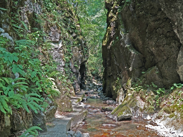
- Ishizawa Waterfall and Byōbu-iwa (Folding Screen Rocks)
- About 30 million years ago, before the Sea of Japan existed, this area was on the eastern edge of t...
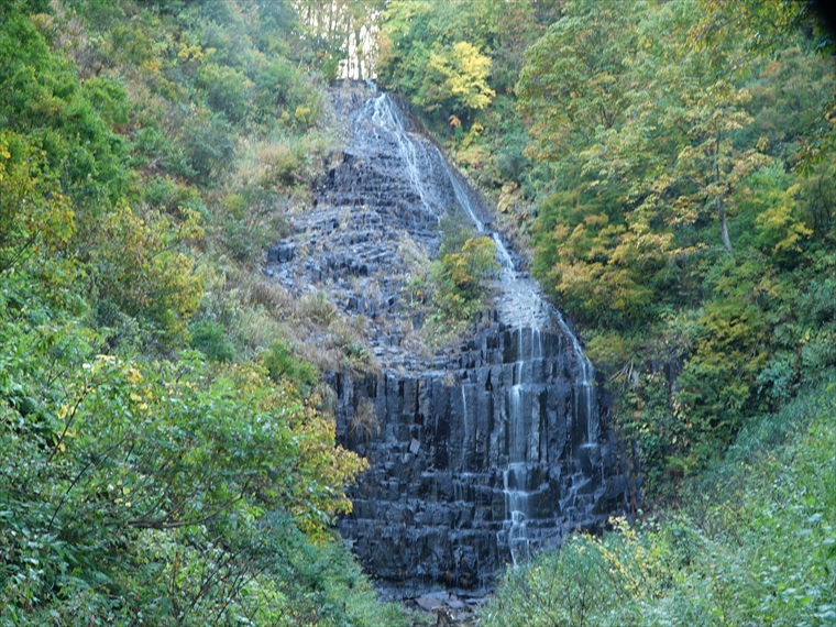
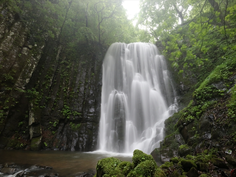
- Hiyama Waterfall
- Hiyama Waterfall is located where Sawauchi River flows over stair-like columnar joints, with an esti...
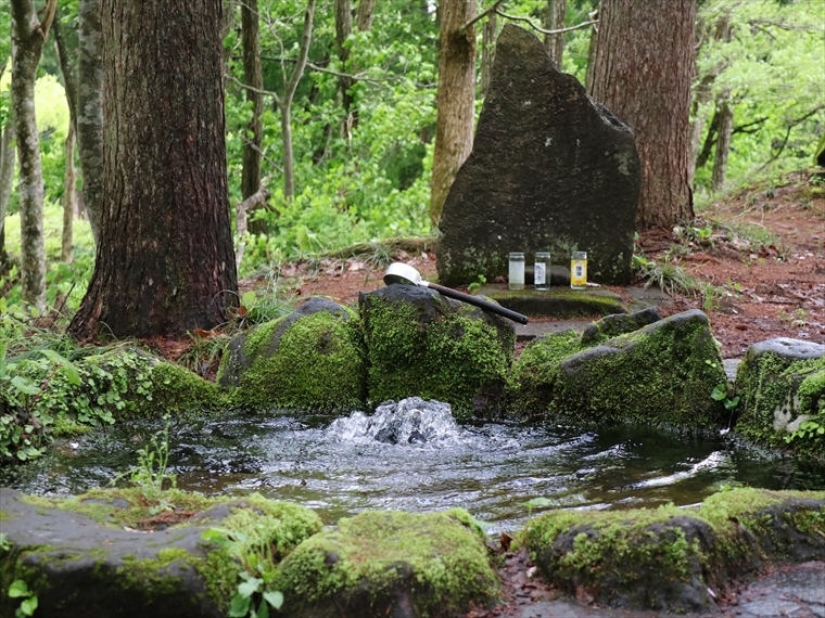
- Botsumeki Spring
- This natural spring is located on the east side of Mt. Yashio, where its steep slope changes to a ge...
- Large Fold Outcrop, Miyazawa Forest Road
- Three million years ago, tectonic plate movement began pushing on the Japanese archipelago from the ...
- Hottai Waterfall and Potholes
- In an eruption of Mt. Chokai about 100 thousand years ago, a large amount of lava flowed out, creati...
- Ryūgahara Wetland
- Located at the Yashima-guchi Trailhead of Mt. Chokai at an elevation of 1,170 m, Ryūgahara Wetland i...
- Kameda Fudō Waterfall
- Located around 150 m above sea level, Kameda Fudō Waterfall stands about 25 m tall and 10 m wide. It...
- Akata-ōtaki Waterfall
- This 23-meter-tall waterfall has an interesting shape, causing its flow to change direction near the...
- Shinzan Park (Shinzan Andesite)
- About 8 million years ago, when this area was part of a shallow sea, submarine volcanoes erupted and...
- Ishizawa Waterfall and Byōbu-iwa (Folding Screen Rocks)
- About 30 million years ago, before the Sea of Japan existed, this area was on the eastern edge of t...
- Hiyama Waterfall
- Hiyama Waterfall is located where Sawauchi River flows over stair-like columnar joints, with an esti...
- Botsumeki Spring
- This natural spring is located on the east side of Mt. Yashio, where its steep slope changes to a ge...
- Moriko Ōmonoimi Shrine
- This shrine has a sacred atmosphere and is surrounded by Japanese cedar trees (Cryptomeria japonica)...
- Yurihara Plateau
- Over a long period of time, a large portion of land that accumulated from a debris avalanche on Mt. ...
- Kizakai Ōmonoimi Shrine
- Kizakai Ōmonoimi Shrine was once a hub for practitioners of the ascetic religion Shugendō in the Yas...