
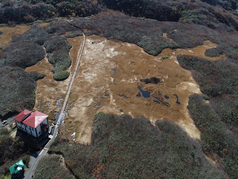
Located at the Yashima-guchi Trailhead of Mt. Chokai at an elevation of 1,170 m, Ryūgahara Wetland is a bog with an area of about 400 m east to west and 300 m north to south. At the place where the lava flow of Shichikōsan Peak ended in an eruption of Mt. Chokai about 20 thousand years ago, water flows from a natural spring, forming a wetland. The land where it formed is the remains of the Yurihara debris avalanche, which occurred between 400 thousand and 160 thousand years ago. Ryūgahara Wetland is designated by the Ministry of the Environment as one of the 500 Important Wetlands of Japan.
A wooden walkway is maintained through the wetland, and one of the Mt. Chokai hiking routes passes through here. By stepping from the wetland path onto the hiking trail, visitors can feel a time scale of more than 100 thousand years.
Several ponds lie across the wetland. Many alpine plants grow here, including some rare ones. It is said that in the past, hikers would pray at Haraigawa Shrine and purify their bodies in the cold spring water of one of the ponds before continuing up the mountain.


