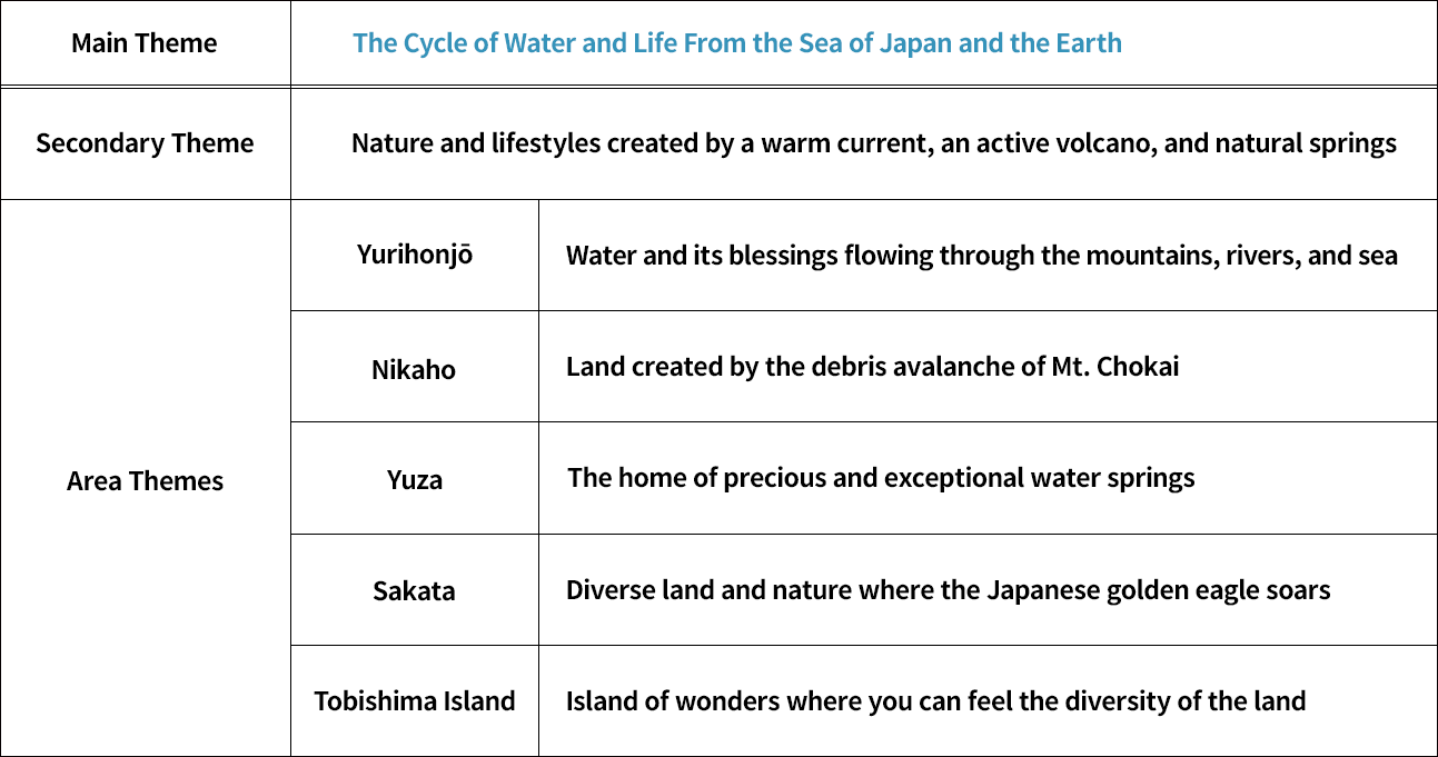
The overall theme of the Mt. Chokai & Tobishima Island Geopark is “The cycle of water and life from the Sea of Japan and the Earth.” Expanding on this main theme, there is a secondary theme, “Nature and lifestyles created by a warm current, an active volcano, and natural springs.” Each of the five areas within the geopark also has its own theme, making it easier for us to understand the region as a whole in terms of its geological, natural, and cultural characteristics.
Formation of Mt. Chokai and Tobishima Island
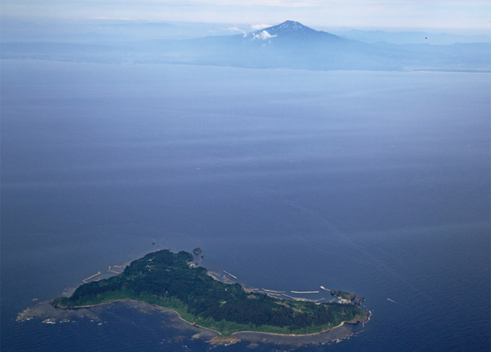
About 15 million years ago, a part of the land separated from the Eurasian continent and gradually rotated, forming the early stages of the Japanese archipelago and the Sea of Japan. About 5 million years ago, pressure from the Pacific Ocean side began to push strongly against northeastern Japan, causing the land to uplift drastically. This uplift formed the Dewa Mountains about 3 million years ago. Tobishima Island is thought to have formed around this time, uplifting from the bottom of the sea (the land itself had already been created by volcanic activity at the bottom of the sea, about 10 million years ago).
About 600 thousand years ago, Mt. Chokai began to form atop the Dewa Mountains. The mountain continued to grow, building layer upon layer of rock from numerous lava flows. This growth was interrupted multiple times by large collapses, creating the characteristic shapes and landscapes at the foot of the mountain.
In winter, strong seasonal winds blow through the area, carrying with them plenty of water vapor from the Tsushima Warm Current. As the winds hit Mt. Chokai, they cause large amounts of snow and rain to fall. The snow and rain seep into the ground and accumulate in cracks and between the layers of rock that make up Mt. Chokai, travelling slowly underground and creating springs and rivers over a long period of time. This water flows into the Sea of Japan and eventually turns into water vapor, once again becoming the source of the rain and snow that falls on Mt. Chokai.

Culture Connecting Mt. Chokai and Tobishima Island
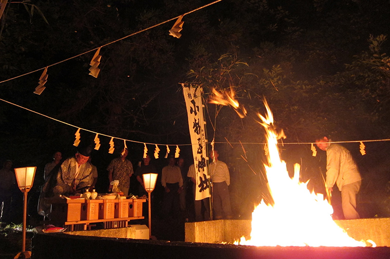
There are many cultural connections between Mt. Chokai and Tobishima Island. One representative example is Mt. Chokai Ōmonoimi Shrine (Yuza Town) and Omonoimi Shrine (Tobishima Island). Both are ancient shrines mentioned in the Engishiki, a 10th century book of laws and customs of the Imperial Court. During the period when the Imperial Court was carrying out the Japanization of the Tōhoku region (Northeast Japan), Mt. Chokai was revered as a deity protecting the nation near its border.
Tobishima is an offshore island enshrining a deity that is a pair together with the deity of Mt. Chokai. The Hi-awase Bonfire Ritual, held annually on July 14 at both shrines, is an ancient ritual to confirm each other’s presence.
Sea Routes and Mt. Chokai and Tobishima Island
During the 17th to 19th centuries, Sakata City thrived as a busy port for shipping routes on the Sea of Japan. Because of its location at the mouth of a river, it was sometimes difficult to enter the port due to changes in the shape of the land caused by rising water or strong winds. In these cases, ships bound for Sakata had to stop on Tobishima Island off the coast, waiting there for favorable conditions. Other ports at the foot of Mt. Chokai also benefited from Tobishima Island’s presence, including Ishiwaki Port and Furuyuki Port (present day Yurihonō City), Konoura Port and Ōma Port (present day Nikaho City), and more.
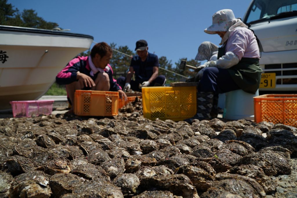
Mt. Chokai has served fishermen throughout the years for navigation, fishing, and as a tool for predicting weather conditions. For these fishermen, the mountain has long been an object of prayer for good fishing catches and marine safety.